Course Details and Site Layout
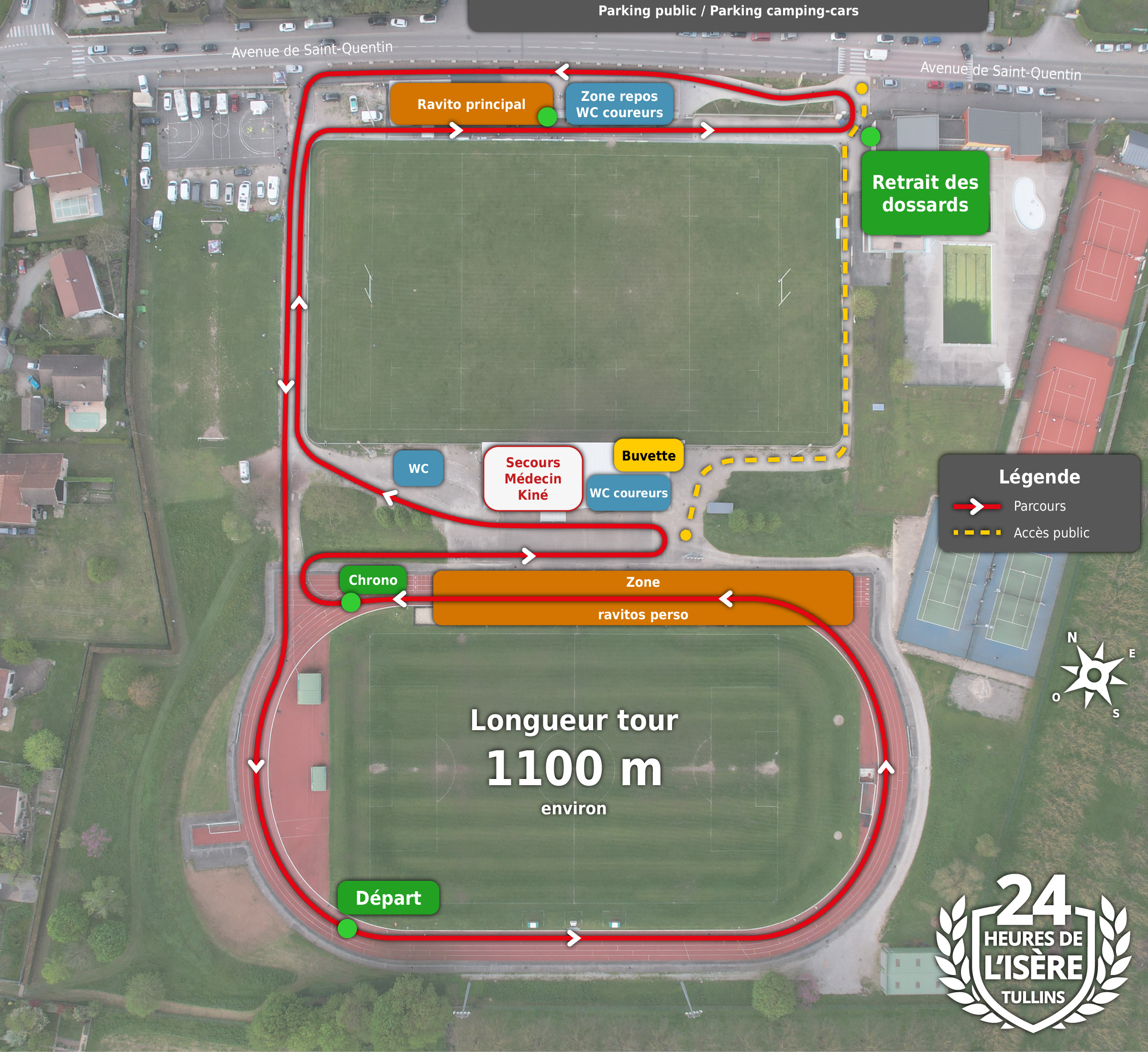
Total distance: approximately 1,100 metres. 40% on the tartan track, 40% on hardpacked trail, 20% on asphalt.
The course is very well suited to performance for those chasing impressive marks. The men's record stands at 261.785 km (set by Diego Filiu) and the women's record at 230.520 km (set by Corinne Gruffaz), both achieved in 2025. (see the history of records)
The course is fully secured (no car traffic), fully lit, and dedicated to running only. All the necessary facilities are in the immediate vicinity: toilets, changing rooms, water points, aid stations, and a rest and first aid room. Personal stands will be sheltered by gazebos, and there are large car parks near the stadium entrance.
Access
The course is located at the Jean Valois Stadium, avenue de Saint-Quentin, 38210 Tullins.
By Train
The Jean Valois stadium is located 300 metres from Tullins-Fures station, down avenue de Saint-Quentin.
By Car
- From Lyon, follow signs for Grenoble via the A43 then A48 motorway, take exit Rives (exit 9, A48), then follow signs for Rives, Renage and Tullins.
- From Grenoble, follow signs for Valence via the A48 then A49 motorway, take exit Tullins (exit 11, A49), then follow signs for Tullins.
- From Valence, suivre direction Grenoble par l’autoroute A49, sortir à Tullins (exit 11, A49), then follow signs for Tullins.
On Google Maps or Waze, search for "Les 24 Heures de l'Isère à Tullins" or "Stade Jean Valois, Tullins" to find us directly!
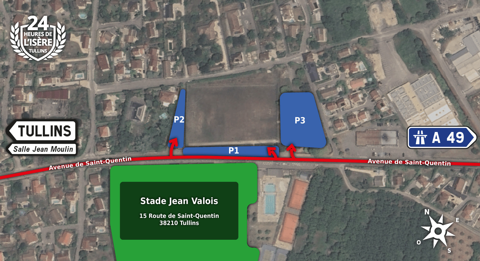
Parking
Several car parks are available in the immediate vicinity of the stadium. Please respect the designated parking spaces!
You might be looking for:
- About Tullins (location and weather)
- Sleep On-site / Accommodation Nearby
- FAQ